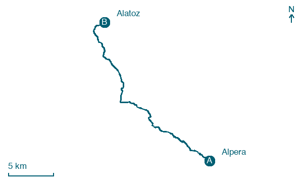
Alpera → Alatoz
Walking distance 25.6 km
Download Appy for the stage map
Stage information
- Ascent
- 266 m
- Descent
- 276 m
Difficulty: challenging (estimated)
Walking the stage
Wander 26 km from Alpera to Alatoz via Las Fuentes and Casas de Don Pedro, climbing 266 m.
Before leaving Alpera, locate Pozo de nieve de Alpera on the map. It is close to the starting point. On arrival in Alatoz, consider a stop at Church of San Juan Bautista, close to the finish.
Look for these places on the stage map: Las Fuentes and Casas de Don Pedro.
What to see on this stage
History and landmarks
Church of San Juan Bautista
Church · 200 m from the trail as the crow flies
A neoclassical parish church of the eighteenth century, blessed in 1780 and declared a Bien de Interés Cultural. Its lime-and-stone walls with brick courses recall the Toledan technique, and cut stone frames only the doors, cornices and tower corners.
Pozo de nieve de Alpera
900 m from the trail as the crow flies
18th-century monument, in Alpera, Spain, designated as bien de interés cultural.
Nature and landscape
Cerro de las Cabras
Summit · 1.3 km from the trail as the crow flies
Cerro Gordo
Summit · 1.6 km from the trail as the crow flies
Map · Alpera → Alatoz
Take your walk with you: download Appy
Camino de la Lana: Alpera → Alatoz. Explore maps, stages and elevation in the app, and plan your train or bus journey.

