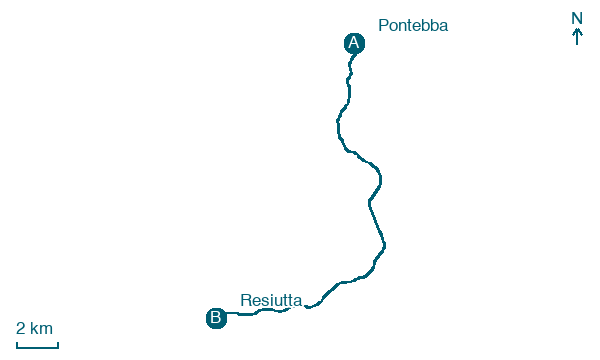
Pontebba → Resiutta
Walking distance 21.1 km
Download Appy for the stage map
Stage information
- Ascent
- 451 m
- Descent
- 704 m
Difficulty: moderate
Walking the stage
Head from Pontebba to Resiutta over 21 km, passing Dogna, Chiusaforte and Casasola, with 451 m of climbing.
Before leaving Pontebba, locate Tiglio selvatico di Chiesa del Calvario - Via Pramollo, Pontebba on the map. It is close to the starting point.
Look for these places on the stage map: Dogna, Casasola, Roveredo, and Ovedasso.
What to see on this stage
History and landmarks
Church of St. Leonard
Church · 200 m from the trail as the crow flies
Monte Posar
1.9 km from the trail as the crow flies
Nature and landscape
Tiglio selvatico di Chiesa del Calvario - Via Pramollo, Pontebba
Monumental tree · 500 m from the trail as the crow flies
Italy’s monumental tree register identifies this specimen as Tilia cordata Mill. It records a height of 25 m and a trunk circumference of 402 cm.
Pero selvatico di Via del Bosco 25, Pontebba
Monumental tree · 800 m from the trail as the crow flies
Italy’s monumental tree register identifies this specimen as Pyrus pyraster (L.) Burgsd. It records a height of 18 m and a trunk circumference of 250 cm.
Map · Pontebba → Resiutta
Take your walk with you: download Appy
Romea Allemagna: Pontebba → Resiutta. Explore maps, stages and elevation in the app, and plan your train or bus journey.

