Terradillos de los Templarios → Bercianos del Real Camino
Walking distance 23.6 km
Download Appy for the stage map
Stage information
- Ascent
- 207 m
- Descent
- 238 m
Difficulty: moderate (estimated)
Walking the stage
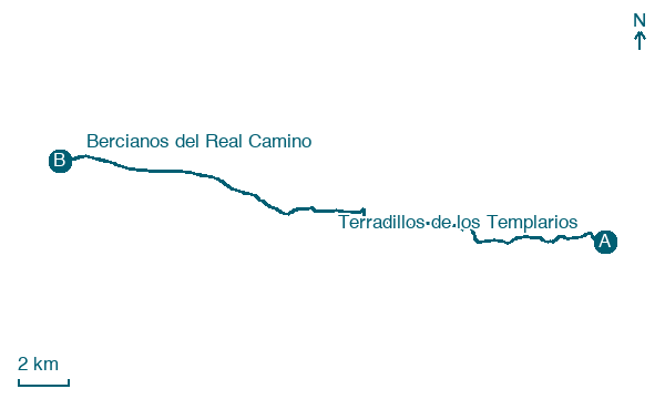
Trace 24 km from Terradillos de los Templarios to Bercianos del Real Camino via Moratinos and Sahagún.
Before leaving Terradillos de los Templarios, locate Public Fountain of Terradillos de los Templarios on the map. It is close to the starting point.
Look for these places on the stage map: Moratinos, San Nicolás del Real Camino, Sahagún, and Calzada del Coto.
What to see on this stage
History and landmarks
Puente Canto
Bridge · < 100 m from the trail as the crow flies
Bridge, in Sahagún, Spain, designated as part of UNESCO World Heritage Site.
Public Fountain of Terradillos de los Templarios
< 100 m from the trail as the crow flies
Fountain, in Lagartos, Spain, designated as part of UNESCO World Heritage Site.
Map · Terradillos de los Templarios → Bercianos del Real Camino
Take your walk with you: download Appy
Camino Frances: Terradillos de los Templarios → Bercianos del Real Camino. Explore maps, stages and elevation in the app, and plan your train or bus journey.

